Liathach
Liathach
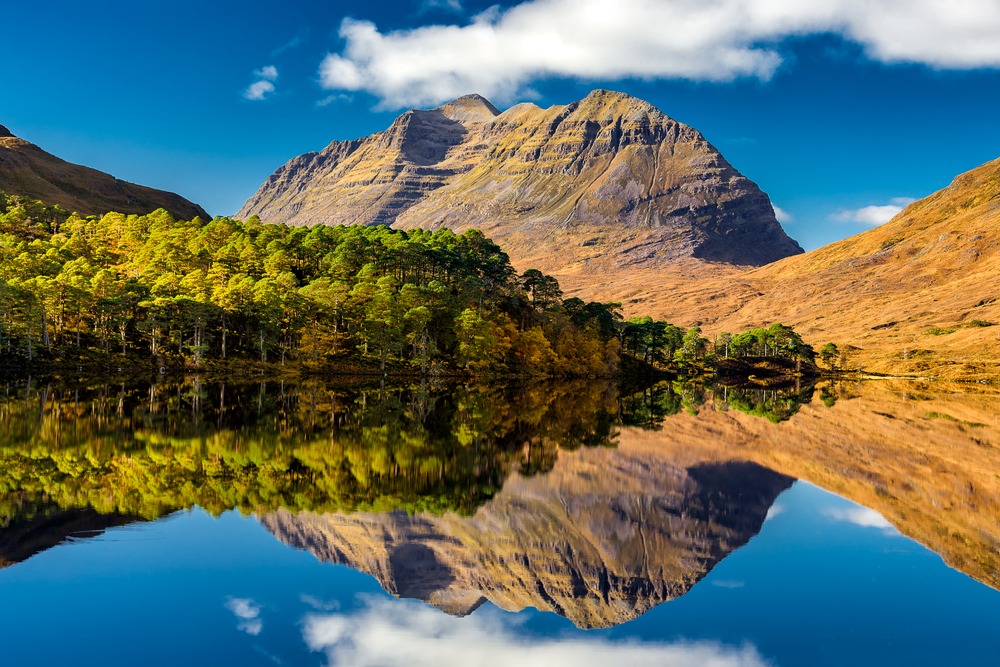
Liathach, 'the grey one,' rises with jagged ridges above Glen Torridon. A demanding alpine traverse, among Europe's oldest rock formations, with panoramic views over Atlantic islands.
Liathach — 'the grey one' in Gaelic — is one of the most imposing massifs in the Scottish Highlands, dominating Torridon valley in northwest Écosse. Its white quartzite crests and Torridon sandstone, 750 million years old, form a jagged ridge stretching nearly 8 km. The complete ridge traverse is considered one of Britain's most demanding alpine hikes.
Quick reference
- Access: Start from Glen Torridon car park, on the A896 road, between Kinlochewe and Torridon village.
- Entry: Free — no ticket required.
- Recommended duration: 7 to 9 hours for the full traverse; allow a full day.
- Level: Serious alpine hiking — unequipped scrambling sections on the Fasarinen ridge; mountain experience essential.
- Equipment: OS map, compass, waterproof clothing, rigid mountain boots mandatory.
- Accessibility: Not wheelchair accessible — highly technical alpine terrain.
- Dogs: Not recommended on the main ridge due to exposed sections.
What you'll see
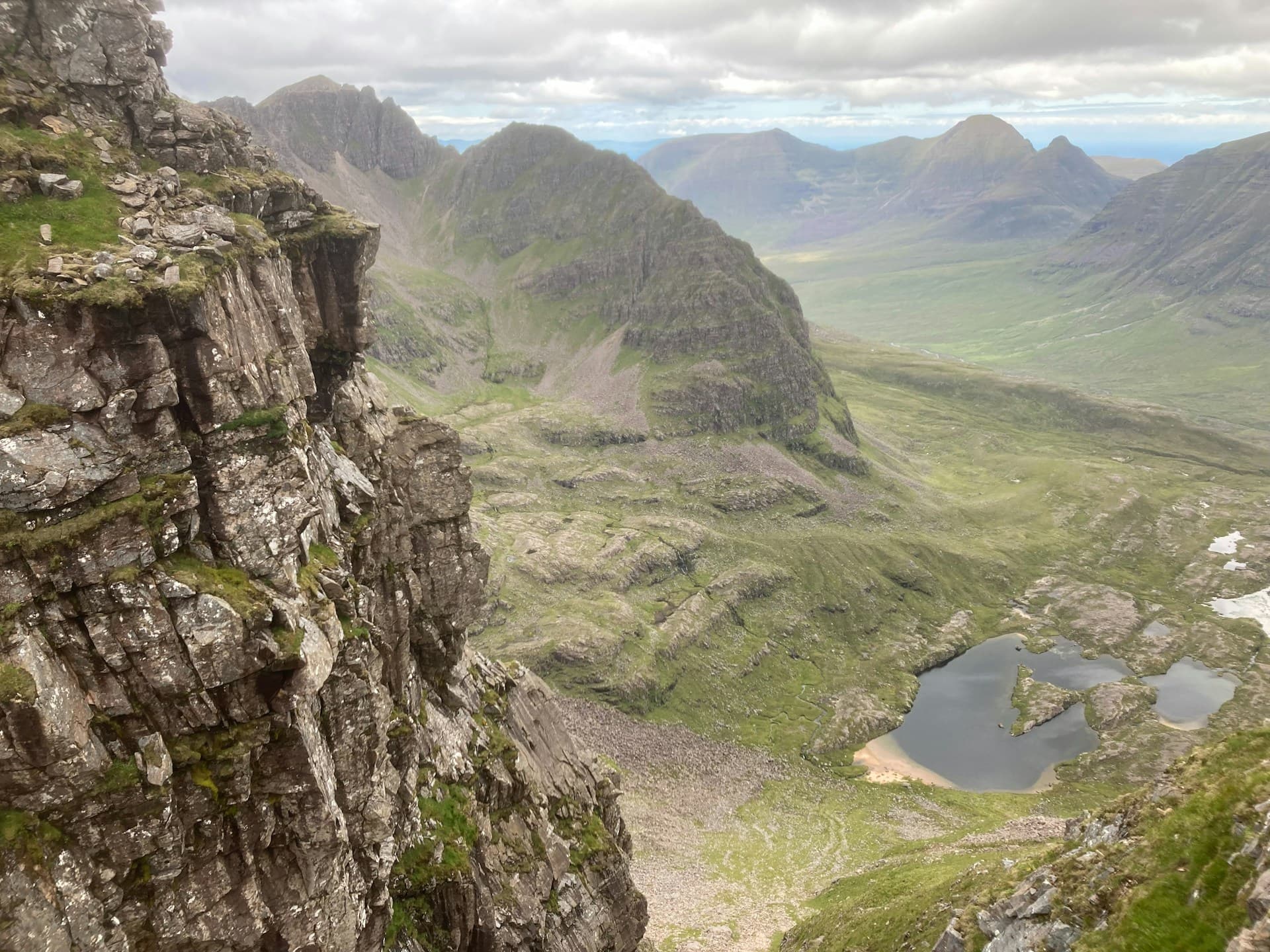
The massif aligns two main peaks: Spidean a' Choire Léith (1,055 m, the highest point) and Mullach an Rathain (1,023 m). Between them stretches the Fasarinen Pinnacles ridge, a series of quartzite needles requiring hand work. Views sweep across Loch Torridon, the islands of Skye and Rùm on clear days, and the vast Beinn Eighe plateau.
History and context
The Torridon sandstone forming Liathach's lower flanks is among Europe's oldest sedimentary rocks, deposited approximately 750 million years ago. The white quartzite summits capping the mountain are more recent — around 500 million years old. The Torridon region is designated a Site of Special Scientific Interest (SSSI) and is largely managed by the National Trust for Scotland.
Highlights of the visit
The Fasarinen Pinnacles ridge
The most spectacular and technical segment of the traverse. The quartzite needles require some straightforward scrambling moves (grade I/II in dry conditions). A bypass exists on the north side for less confident hikers, though it remains exposed.
Spidean a' Choire Léith summit
The massif's highest point at 1,055 m. In fair weather, the panorama encompasses much of the northwest Scottish landscape: Loch Maree, An Teallach, and the Atlantic islands. The summit cairn marks the end of the most direct ascent from Glen Torridon.
The north gully (Coire na Caime)
In winter, Liathach's north gullies offer snow and ice conditions that attract alpinists. The mountain takes on a striking arctic character, but avalanche risk is real — careful assessment of conditions is essential.
Photography tips
Morning light illuminates the red sandstone cliffs from the east side of the valley — the Loch Torridon shoreline offers ideal foreground reflections. From the ridge, the Fasarinen Pinnacles photograph well from Mullach an Rathain looking east. In autumn, violet heather and russet ferns contrast with the white quartzite of the summits.
Location and access
Liathach sits in Glen Torridon valley, about 10 km west of Kinlochewe, accessible via the A896 road. Torridon village, on the loch shore, has a National Trust for Scotland visitor centre with information and maps. Inverness is the nearest city with an airport, roughly 90 km to the east. No regular public transport runs to the trailhead — a car is practically essential. Local mountain guides offer guided outings from Torridon.
Nearby attractions
- Beinn Eighe — the UK's first national nature reserve, just to the east, with marked trails accessible to all levels.
- Loch Torridon — steep-sided fjord at the foot of the massif, ideal for sea kayaking and seal spotting.
- Beinn Alligin — the third major Torridon massif, slightly less technical than Liathach, with its own quartzite horns.
- Kinlochewe — staging village with hotel and shops, starting point for several routes in the region.
Frequently asked questions
Not strictly speaking, but solid mountain hiking experience is essential. The Fasarinen Pinnacles involve hand work and exposure. Beginners should abstain or opt for a guided outing.
May through September offers the best conditions. July and August are the driest months. In winter, the mountain becomes fully alpine and requires ice axe and crampons.
Yes — the two massifs are less than 15 km apart. Plan for at least two separate days, each being a long hiking day. Kinlochewe or Torridon make ideal bases.
It's possible to ascend only Mullach an Rathain (the west summit) without crossing the Pinnacles, reducing technical exposure. The climb remains long and demanding, but without mandatory scrambling sections.
Seasonal bus services connect Inverness to Kinlochewe, but frequency is very limited. A taxi or transfer from Inverness remains the most reliable option to reach the trailhead.
No restrictions — the mountain is open natural space. Drones: check current CAA regulations for Écosse's protected natural areas before flying.
Interested in this visit?
We can include it in your personalised itinerary.